Cold air flows – also known as cold air systems or cold air induction corridors – have a major impact on the climate of a town or city. They play a significant role in allowing built-up areas to cool down at night, so helping the inhabitants to get a good night’s sleep when it is hot. To ensure that cold air induction corridors continue functioning, it is firstly necessary to protect the sites where cold air forms and secondly, to make sure the air flows are not obstructed. Both objectives are achieved by examining planned construction projects where an urban climate analysis or a cold air map shows that they are located in a cold air induction corridor.

Weatherpark uses the KLAM_21 cold air drainage model to simulate the impact of sealed areas and buildings on cold air flows. Whether a building forms an obstruction generally depends on how it is erected. Its size and orientation determines whether a cold air induction corridor will be severely affected or possibly not at all. Should a study show that a project will cause problems for the formation of cold air or cold air drainage, Weatherpark can then advise on possible measures, if wished.
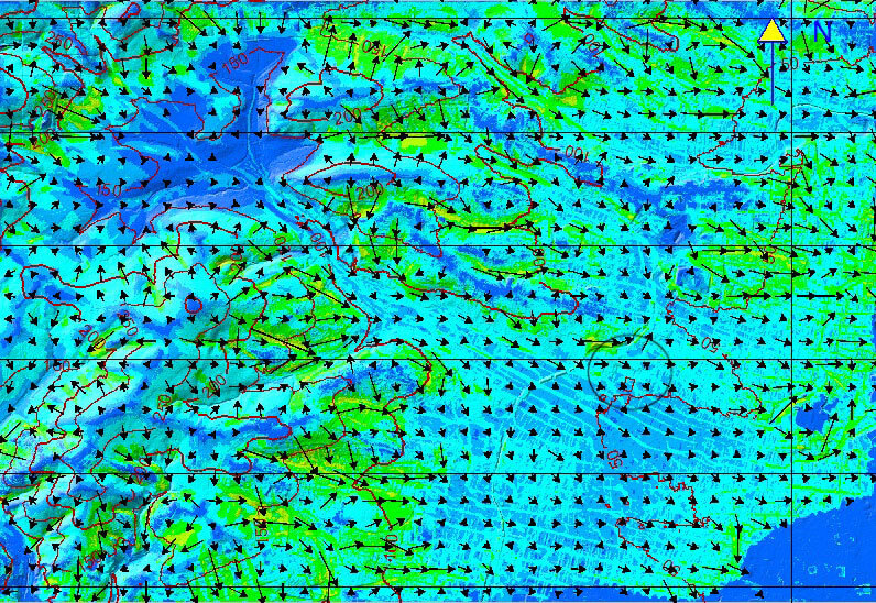
This example maps the results of a KLAM simulation (see left) and shows the flow velocity and field of cold air at a height of 10m after 8 hours commencing shortly before sunset.

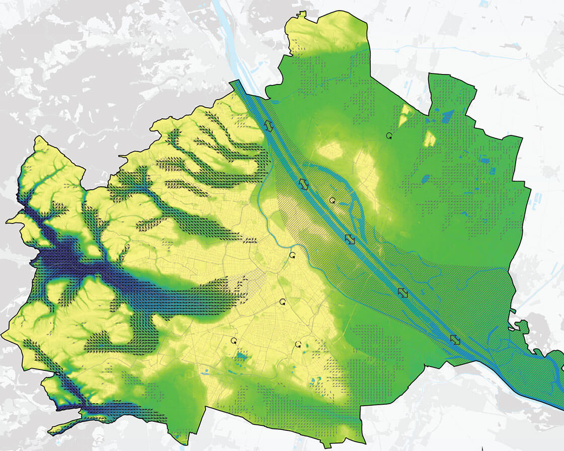
The cold air map of a town or city (in this case Vienna) indicates how the – mostly cooler – air enters the city at night from the land surrounding it, where it then flows to and the effects it has there. This knowledge is essential to prevent the cold flow system from being impaired by future urban development and to so ensure that the city is still able to cool down at night. Large sealed areas and structures which are to be built in cold air induction corridors should thus be examined to identify and prevent any negative impact.
The model simulates the development of cold air flows and the accumulation of cold air in an arbitrarily selectable, rectangular limited study area. Here it is possible to model obstacles rising from the terrain (e.g. individual buildings, embankments, noise barriers) which can only be overcome by the cold air once it has reached a corresponding height. The interaction between these influencing variables determines the formation, flow and accumulation of cold air. In contrast to highly simplistic models, which are based on a “static” analysis of the relief and land use, cold air movements can be extensively reproduced in their dynamics and temporal development with KLAM_21. The result is the areal distribution of the cold air height and its mean flow velocity or volume flows available at any time during the simulation. The comparison of actual and planning states is visualised with difference maps or temporal animations of the cold air height, the flow velocity or the volume flows.
Source: https://de.wikipedia.org/wiki/Kaltluftabflussmodell_KLAM_21